Sunday, September 23, 2007

Darjeeling...Our Intro Into India

Varanasi, India - We had planned to hire a row boat to take us out on the Ganges this morning, but the weather turned nasty last night and it's still wicked blowy out there right now. So, we'll take this time to tell you about our first impressions of India and our time in Darjeeling.

Coming into India from Nepal, the first thing we noticed is that the Indians seem to hold the same high regard for random, ear-shattering noise that the Chinese do. It wasn't even 7 in the morning when we crossed the border, and the shop keepers already had the speakers set up outside blaring music so loud, and so distorted (due to blown out speakers) that it was hard to recognize as music.

The next thing we noticed was the sheer amount of people. Its hard not to notice them when they stick their butts in your face while trying to clamor over sacks of garlic, our backpacks, and us to get to the one free seat on the bus. In India too, they all seem to be moving. We didn't see as many people passed out asleep in the heat as we saw in eastern Nepal.

That said, we were still pleasantly surprised. After listening to Barb & Ted's stories of Fear & Loathing in India, we half expected monkeys to be lunging for our heads with the intent of stuffing our ears with feces, while we trod on crippled child beggars and beat clingers (touts, taxi drivers & the like) off with our umbrella. To be honest, we really haven't seen that many monkeys. Then again, we haven't been to Delhi yet.


Darjeeling From Our Sweet Hotel Room

Darjeeling, however, isn't the best place to make generalizations about India. Darjeeling first showed up on the map in the early 1800s when the British decided it would be a good place for a sanitarium for soldiers of the East India Company. Soon after that they started growing tea in the region, which is how most people know the name. It still serves as a sanitarium of sorts, as many Indian companies & government offices have set up "holiday homes" along its ridges. And, it definitely still produces tea, accounting for 25% of India's tea production (most of it is sent overseas). With an elevation of over 2000 meters, cool weather, tea fields & mountain views, Darjeeling was a pretty nice place to be.

When we arrived, there was still plenty of people shooting in every direction and plenty of noise blasting from car horns, two-stroke motorcycles, generators, & of course many large, blown-out speakers. It seems "Indian Idol" (just like American Idol) is quite the phenomena in India, and especially so in Darjeeling. It was the final week of the season and the contest had been whittled down to two singers, Amit Paul from Shillong & Prashant Tamang, the local darling from Darjeeling. Darjeeling was going nuts, blasting his hit song on continuous repeat from 7 in the morning till 8 at night. (It will prove to be a serious earworm for the rest of the trip.) There were call booths set up every couple of feet throughout town to allow people to call in their votes in support for Prashant. Everyone was talking about it. We read in the newspaper that the sale of alcohol in Darjeeling had been prohibited from the 22nd to the 24th for fear of what might happen if he won...or lost.


Indian Idol call booth, sponsored by the Darjeeling Police. Prashant, the Darjeeling local contestant, was working as a police officer in Calcutta.

We, on the other hand, were there for more touristic reasons. We spent Thursday getting up very, very early and catching a taxi to Tiger Hill. We didn't see any tigers, but we did catch one hell of a sunrise. We spent most of the morning walking the seven miles back to town along the ridge that Darjeeling is perched upon.


Sunrise at Tiger Hill


Friday, we visited the Zoo. Not that I like zoos, but the Himalayan Mountain Institute, tucked away in the back of the zoo, had two nice museums located inside, the Himalayan Mountaineering Museum & the Everest Museum. Both managed to be quite interesting...plus we got to see a tiger. So, it was all good.


The Darjeeling Zoo. Not a tiger. This, however, was a better zoo photo. If you want to see the tiger, go to the slideshow.

That afternoon we learned all there was to learn...scratch that...all we cared to learn about Darjeeling tea. While wandering the Happy Valley Tea Estate, we happened upon a small snack shack amongst the bushes, and met the "tea lady." The Tea Lady was a pure pleasure to listen to, even if we didn't understand half the stuff she was telling us. Just remember SFTGFOP. Darjeeling teas are considered by many (including the British, who seem to know a lot about tea) to be the finest of the black teas and the highest quality of Darjeeling teas is graded as SFTGFOP...or "Special, Fine, Tippy, Golden, Flowery, Orange, Pekoe." I wrote it down because I knew I would never remember. Anyway, we had a cup...and yes, it was pretty damn tasty. She was quite proud that she could make a cup of "5 second" tea in about 3 seconds.


The Tea Lady


The Happy Valley Tea Estates


We really liked Darjeeling. Oh...by the way. Prashant won Indian Idol last night, but we were already in Varanasi so we missed any potential craziness.

http://indianidol.sify.com/

Here is the slideshow with some more Darjeeling photos:

Darjeeling, India

Wednesday, September 19, 2007

Rafting The Sun Kosi

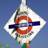
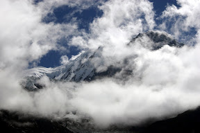
Darjeeling, India - Yes, we made it to India. In the last week we've braved landslides, torrential rains, thieves, bus strikes, backwater borders, broken trains and packed jeeps. But now we have a nice room high up on a hill overlooking central Darjeeling. I'm sitting in a nice cafe sipping on a cup of milk tea and I'm ready to write about the Sun Kosi.


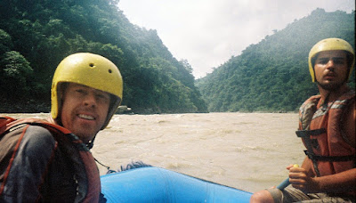
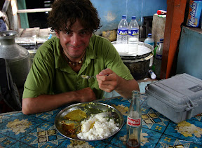
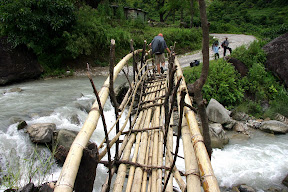
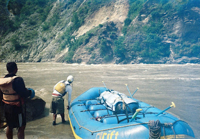
Ben, Suwei, Kamal & JB at the start of the trip.


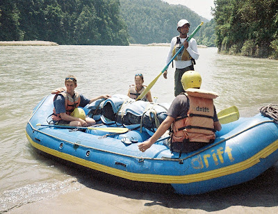
On Tuesday the 11th we set out to raft the Sun Kosi. The name "Sun Kosi" means gold river. Some say that the name comes from the gold that can be panned from the river, others say it is from the gold or milky-brown color of the river caused by massive amounts of silt being washed down from the mountains. Gold or silt, either way, I sure had a lot of it stuck in just about every crevice of my body after 7 days on the river.

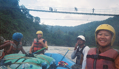
There were 11 of us on the trip, 5 tourists and six Nepalis. Of the tourists, Suwei & I, Ben (UK), & JB (France) were in the raft and Johnny (Telluride, CO) was kayaking. The Drift Nepal crew included Kamal, our raft guide, Indra, the safety kayak, Babu, pilot of the gear raft and 3 other Nepali guys who came along for training.

We entered the river near Dolalghat and traveled 170 miles (270km) east to Chatra. Normally, this would take close to 10 days, but due to high water and one hell of a fast current, we finished in a week (3 days of which were half days). Setting out we were a little worried that the high water would make the river a little too wild for our tastes and talking to the guides in Kathmandu did little to make us feel better. In the end, however, it seems the high water washed out much of the tough stuff, and although we got a lot of exciting big water we really didn't see anything above a class 4, most of the rapids being large rolling class 3's.


Lunch stop


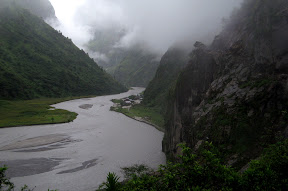
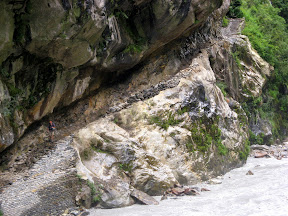
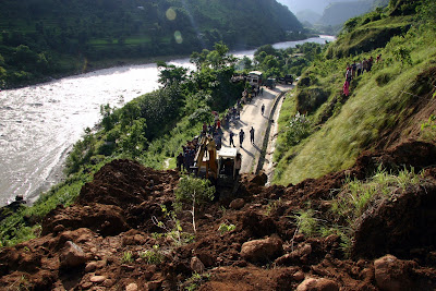
On day two however we got some very unexpected excitement. A landslide! Ben, just in time for the big event, had traded Johnny a seat on the raft for a bit of time in the kayak. He and the other two kayakers were about 100m in front of us when a large portion of rock came loose from the cliff above and landed in the river right next to them. They began to paddle away quickly. One of the trainees in the second safety kayak managed to flip over and was having a hard time righting himself. That's when the whole hill started to go. A section of the valley about 100ft high and maybe half that wide began to slide quickly towards the river. The gear raft now floated into range trying to warn the flipped kayaker that he needed to get out of there. Trees, rocks, mud, grass, bushes and dirt all came tumbling into the river not 20ft away from all of them. A huge wave was formed. It flipped Ben out of his kayak and onto shore. The gear raft reached the swimming kayaker and was nearly flipped by the wave too. As we approached the bend, the wave, now traveling upstream hit us head on. It was full of debris...mud, wood and leaves and must have been close to 10ft by that time. A full tsunami...it washed over the riverbank close to 60ft inland, leaving fish high and dry on the sand. We had to paddle "HARD!" (as Kamal would say) as the wave receded and tried to suck us back into the still crumbling wall. We all pulled ashore and spent the next hour or so talking about how lucky we all were and watching as the remainder of the hill continued to fall into the river one clump of rock at a time. Suwei gathered up a few of the beached fish and put them back into the water.
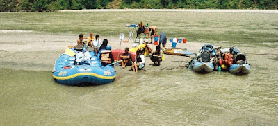
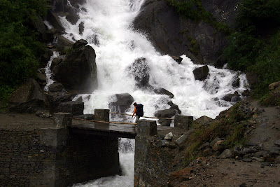
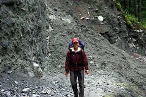
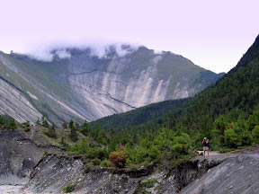


The Landslide


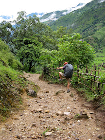
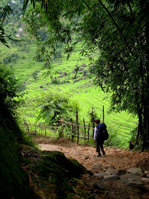
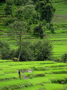
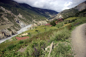
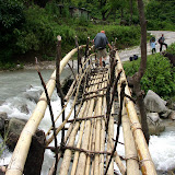
The rest of the trip paled in comparison. We had a few near flips and one of the Nepalis got bounced out on one of the rapids, but generally we spent most of the time drifting through a stunning valley full of remote villages, past overly green rice paddies and tea plantations. Kids would yell to us from the beaches, trails, shacks and bridges that lined the river. There were no roads for the entire 170 miles and it wasn't until the last day that we saw power lines and electric lights. We spent our evenings on white sand beaches, resting, reading, playing Frisbee and providing endless entertainment for the locals.


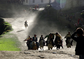
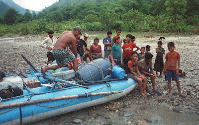
Babu Entertaining the Locals

Our last night on the river we were joined by the crew from another raft company (Ultimate Descents Nepal, the only other crew on the river) and camped on yet another perfect beach near a village. Local kids were playing in the incredibly strong current. Johnny and JB were able replenish their kit with some local weed. We spent the afternoon reading and napping under a shelter constructed using the raft and a tarp-- first the shelter protected us from the incredibly strong sun, then torrential rains. However, it did nothing for the unbelievable humidity. We were now in the Terai region of Nepal ready to enter the wide plains of India. If we kept going we would soon be floating into Calcutta.


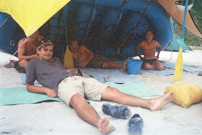
Johnny, JB, Ben & Suwei working hard in the Afternoon

That very night we were visited by thieves. Both Suwei and I were woken late that night by barking dogs. I got up to take a look and saw two flashlights lighting up the fog further down the beach in the Ultimate Descents Nepal camp. Not thinking much of it I returned to the stuffy, sandy dampness of our tent and went back to sleep. The next day we learned that both camps had been hit by thieves. Johnny took the hit in our camp, as he was sleeping out near his kayak but had retreated to the raft shelter when it started to rain. He had left his gear box underneath the kayak and from that box, they had taken his camera, Ipod, sunglasses, the glue and wooden dipstick from his Thermarest repair kit, and the scissors, tweezers & clippers from his medical kit. It was obvious that the thieves were not in a hurry. In the Ultimate Descents Nepal camp they actually took a dry bag that one of the guides was using as a pillow. In the bag were two cell phones, the guide's wallet with trip money, and other random gear. The event dampened an already damp morning, but Johnny and the others handled it in stride and wouldn't let it get them down too much. After all, we still had one more day on the river.

In Chatra we made a stop at a riverside temple, where one's manhood could be tested by carrying a very, very heavy rock. The rock was freakishly heavy for its size and many of the guys took turns seeing how many times they could round the temple before their arms, shoulder, back or knees gave out. I gave it a pass. After 6 months of traveling I know I'm weak. I don't need a heavy rock to prove it. One of the guides made it around 7 times.


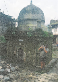
One of the Ultimate Descent Guys Rounds the Temple


We had one more set of rapids before the hillsides disappeared and we were dumped into a wide delta. This is where we pulled out. We were met by a very Nepali bus (many of the windows had been replaced by plywood, you could see the tires through the floor board, and the luggage racks leaked water when it rained). It took us awhile to make it out to the main road as there was so much gear on the top of the bus that we needed a few guys up there to lift power lines when we drove through villages. Once out at the main road Suwei and I said our goodbyes. The bus was returning to Kathmandu (12-57 hours), but we were continuing east to India.


JB & Johnny

Ben & The Drift Nepal Crew

We caught a very full minibus to Itahari, where we were quickly transfered to a larger bus heading to the border town of Kakarbhitta. We were a little worried about the time as the sun was getting low, but we were assured by the driver that we would make it to the border town by 6:00pm. Well, that was until the bus stopped.

The driver and his helpers disappeared and we figured maybe they went to get some dinner. I got off the bus to find some cooler air and a little food. That's when I saw the burning tires blocking the road (never a good sign). I heard "Strike". We were 35km from Kakarbhitta and it was getting dark. We pulled the bags off the top of the bus and stashed them with us in the back seat. By this time it was dark. I got to talking to some people and they said that indeed there was a bus strike and that most likely no one was traveling anywhere this evening. They suggested finding a hotel. I searched for a hotel and found none. Then the power went out and the town was completely black. At that point we were pretty much resigned to spending the night in the back of the bus.

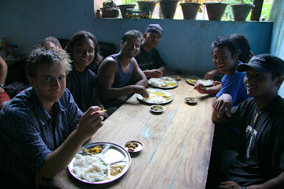
When the power came back on, I ventured out to see what was happening (and to get out of the stuffy bus). I met a young guy that ran a sweet shop in town. He introduced me to his cousin and his cousin's buddy and we chatted over a few cokes. There I learned that a few guys from the controlling party here in eastern Nepal were arrested 4 hours earlier. And that's when their supporters decided to block all the main roads in eastern Nepal. The road wasn't going to open until the men were released. "Maybe tonight, maybe tomorrow, maybe not," the young man told me. He offered to let us stay at his home, but we opted for staying with the bus. The police would come every 15 minutes or so, a crowd would gather, an announcement would be made, then the crowd would disperse and my friend would say, "not yet." Finally, we decided to catch some sleep. Five minutes after I laid down there was a bit of commotion outside. Our driver hopped onto the bus and started it up. Apparently, the road just opened. We made it quickly to Kakarbhitta and found a hotel just before 10pm.

After that things were a piece of cake. We wanted to get an early start as we were trying to catch the narrow gauge "toy train" departing from New Jalpaiguri to Darjeeling at 9am. The border opened at 6am and we were there at 6:05am. We were stamped out of Nepal by a guy still wearing his sleep shirt & boxers. We caught a bus packed with people and sacks of garlic in true India-style and reached Siliguri by 8:30am, where we learned that the toy train was no longer running due to landslides. After 2.5 hours in a jeep with 12 people crammed in, we finally made it here to Darjeeling. More on Darjeeling in the next entry.

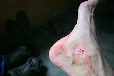
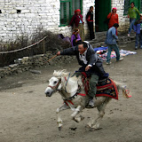
No slideshow this time as the few pictures that were usable are in this post. Sorry for the quality. They were taken with a cheap disposable camera bought in Kathmandu, baked in the sun and battered with sand and silt for a week. The film was then poorly developed and even more poorly scanned at a shop here in Darjeeling. I'm surprised we had any worth using.
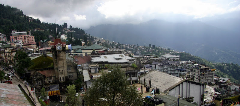
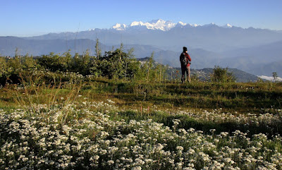
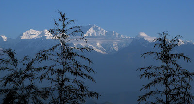
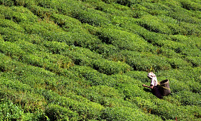
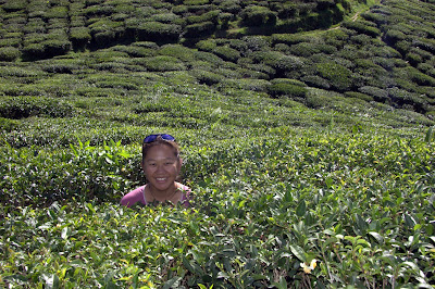
Sunday, September 9, 2007

R&R in Pokhara, Nepal

Kathmandu, Nepal - Pokhara was the perfect place to spend a little R&R after a long hike. It had beautiful lake views, halfway decent steak, cheap barbers, laundry service, and internet fast enough to at least tell people we were still alive. I had a cold to nurse and Suwei needed to let her feet heal. We did manage to take a boat out on the lake and hike up to the World Peace Pavilion, but mostly we just slept , read and watched the rain fall.


Pokhara, Nepal


We are now back in Kathmandu getting ready for our raft trip next week. We will be leaving bright and early Tuesday morning for the Sun Kosi and 8 days of white water rafting. Stay tuned.

Lastly...I don't know if any of you saw this in the news: http://www.voanews.com/tibetan/2007-09-02-voa1.cfm.

I doubt that anyone did knowing the media in the states. If anyone did see it, I'd be interested in hearing how it was reported. Here they are saying that foreigners are not being targeted, but suggesting that foreigners stay away from local transport as the Maoists are notoriously sloppy.

There is no need to worry about us. We are leaving Kathmandu by rubber raft and will be making a quick run to the Indian border after that. With that....we're off to our next adventure.


Enjoy yet another short slideshow with some pictures from Pokhara:

Pokhara, Nepal

Thursday, September 6, 2007

Trekking the Annapurna Circuit

Kathmandu Nepal - The Annapurna Circuit starts off with a 4626m (15,266ft) climb to a high point 5416m (17,873ft) at Thorang La, the circuit's first and, really, only pass. Granted it took us 13 days to make it over, but we felt pretty good about it considering our team's propensity for H.A.P.E., pre-dislocating toes, and insufficient footwear.

Annapurna is a Sanskrit name that means “Goddess of the Harvests” or “The Provider”. Located just north of Pokhara in central Nepal the Annapurna is a 55km-long massif whose highest point, Annapurna I, stands at 8,091m (26,538ft), making it the 10th-highest summit in the world. In 1950 it became the 1st peak over 8000m to be summited successfully.

The Annapurna Circuit itself began as a series of trade routes between Nepal and Tibet. In the 1970s the Annapurnas became a popular trekking destination and now the circuit is one of the most famous treks in Nepal, and for good reason. We chose this trek, not only because it was in a book of world class treks that Suwei got from her brother, but because it looked like one of the most diverse treks in Nepal in terms of ecosystems and culture. Because of the massive elevation gain we were able to hike through jungle, rain forest, high chaparral, cloud forest, alpine regions, and desert. The culture changed from Hindi Nepalis to Buddhist Tibetans and back again. It was not a hike for wilderness, but there were sections where you were definitely out there. We thoroughly enjoyed it!


The Annapurna Circuit


Our choice to do the circuit during the off-season was due to us being here in the off-season. (S - What Karl is trying to say is that we had NO choice on the when.) We knew we would be arriving at the tail end of the monsoon, but were hoping for a dry year. It turned out to be quite the opposite. Folks around here keep telling us that the rainy season was due to end any day now, but the rain keeps falling, land keeps sliding and all the rivers are full. That said, in the end we were glad we did it off-season. True, most of the spectacular peak views were obscured by clouds, but when they did make an appearance it seemed that much more momentous. "There's one!" Click, click, click with the camera then the clouds would move back in. Apple pie was harder to come by and the bakery shelves were empty "no meat, no bread!" What we did like, however, was that we practically had the trail to ourselves. For the first couple of days we only saw a handful of foreigners heading down the trail and it was over a week before we shared a hotel with anyone but local porters. At one empty village a hotel caretaker told us that in high season, 70 to 90 people a day would walk by (others said more), the hotel would be booked, and the floor of the dining room would be littered with bodies. We heard stories of early, early morning starts in order to get to get choice beds and in some cases, beds at all. We, on the other hand, were able to sleep in and wait for the rain to let up.

For a trip full of highlights, the Annapurna Circuit was one of our favorites. Below, Suwei has provided our HAPE inspired schedule. While I was bopping around southern Tibet she was doing research on how someone, who we now know is quite prone to HAPE, could successfully complete a trek that tops out at well over 17,000 ft. She read just about everything on the internet about the condition and spoke to the Himalayan Rescue Association regarding their recommendation. What resulted was a very relaxed, but ultimately successful plan. That said, we were nervous from the time we passed 3000 meters on the east side till the time we got back down to 3000 meters, 10 days later.


Suwei & Pram approaching Thorang La


Day-by-Day
The following are the stats of the trek, a few select pictures and a very short writeup on a per day basis.

Day 1: August 15, 2007
Start:Kathmandu, 1300m
Distance: 190km
Finish: Besi Sahar, 790m
Elevation Change: -510m

Took a public minibus from Kathmandu to Besi Sahar. We left just before 7am and arrived by noon in Besi Sahar even after a breakfast stop of dal bhat and several drop offs and pick ups.

Start:Besi Sahar,790m
Distance: 9km, @9km
Finish: Bhulbhule, 840m
Elevation Change: +50m
Start-Finish Time: 12:30-3:30pm
Total/Walk Time: 3hrs/2.5hrs

This was a great beginning. Followed the road for the most part, but watched with an apprehensive jealousy as a few buses went bouncing by. No rain and lots of sun to boot. Hot and steamy!
K - Things we saw: lots of porters, school kids & donkeys.


Day 2: August 16, 2007
Start:Bhulbhule, 840m
Distance: 13km, @22km
Finish: Ghermu, 1260m
Elevation Change: +420m
Start-Finish Time: 8am-4:30pm
Total/Walk Time: 8.5hrs/5.5hrs

It rained steadily all night long and well into the next morning. Had to do a river crossing within 10 minutes of the start and the choices were either get your shoes and socks wet from the rain or the river. We choose the river and spent the rest of the day squishing up and down lush green valleys.
K - Things we saw: Water running everywhere, mudslides, rockfall, school kids with umbrellas carrying their shoes so they don't get wet, massive loads on stout but stunted men, bored shop keepers, a man threatening a chicken, cows (one head-butted me in the gut) & a stubborn mule that wouldn't budge.


Day 3: August 17, 2007
Start:Ghermu, 1260m
Distance: 12km,@34km
Finish: Tal, 1700m
Elevation Change: +440m
Start-Finish Time: 9am-4:15pm
Total/Walk Time: 7.25hrs/6.25hrs

The day started with no rain! Hurray! But toward the end of the day it started to pour and the wind picked up especially during an uphill push. Toward the end of the hill Karl attracted several leeches. The final approach into Tal was down, however, and this provided us a spectacular view of Tal.
K - Things we saw: Goats trying to stay dry by hiding under a rock, more porters navigating the slippery rocks in flip flops, crazy rapids, blowing clouds, leeches, soaked villages & a damn nice pumpkin curry for dinner.


Day 4: August 18, 2007
Start: Tal, 1700m
Distance: 16km, @54km
Finish: Koto, 2600m
Elevation Change: +900m
Start-Finish Time: 8:15am-5:15pm
Total/Walk Time: 9hrs/8hrs

This was a long day with one scary river crossing (we missed the safe trail via Nadi Bazaar) and a long uphill after lunch in which this 8-year old girl carry her baby brother passed me without even breathing hard. After the climb, the trail became a wide easy road...literally...the Nepalis were trying to build a road to Manang!
K - Things we saw: Kids playing in the mud, kids chasing a rescue helicopter, fog, pine trees, lumberjacks, roadwork, landslides, men playing cards, three girls trying to rock a suspension bridge, prayer wheels, and lots of waterfalls.


Day 5: August 19, 2007
Start: Koto, 2600m
Distance: 9km, @63km
Finish: Bhratang, 2850m
Elevation Change: +250m
Start-Finish Time: 12:15-2:15pm
Total/Walk Time: 2hrs/2hrs

This was the first of a series of short days. I wanted to make sure I ascended no more than 300m/day so I would have no chance of getting HAPE! Though the trail was now a wide road, there were several landslides that were slightly precarious and like quicksand (quickmud to be more exact...just sunk into a foot or more of mud).
K - Things we saw: Apple porridge, a bank straight out of the old west (complete with thick, black ledger books, wood desks, wood floors, wood railings, stone walls , and a guy in a chair with a rifle across his lap leaning against the back wall), very fresh landslides, tall dark cliffs & more waterfalls.


Day 6: August 20, 2007
Start: Bhratang, 2850m
Distance: 11km, @74km
Finish: Lower Pisang, 3200m
Elevation Change: +250m
Start-Finish Time: 9:30am-12pm
Total/Walk Time: 2.5hrs/2.5hrs

Hurray NO rain! Plus the scenery was going from lush tropical forest and rice paddies to sub-alpine forest and wheat fields. We actually could see tree line and smell pine in the air! Saw Pisang Peak for brief moments as clouds passed by.
K - Things we saw: Forest, road crews shoving down dal bhat, the Swargadwari Danda (a huge stone bowl), rock houses, fields of flowers & the snow atop Pisang Peak.


Day 7: August 21, 2007
Start: Lower Pisang, 3200m
Distance: 8km, @82km
Finish: Humde, 3280m
Elevation Change: +80m
Start-Finish Time: 9:15-11:15pm
Total/Walk Time: 2hrs/2hrs

Though it was a lightly cloudy day we still saw lots of peaks, some snow-covered, some gray and jagged. Humde sat in a wide valley and we could see all these mountains past it in the distance. We reached Humde early and spent the afternoon sunning on the hotel deck and taking pictures of the Annapurnas.
K - Things we saw: Stars, more mountains,
two stoned Frenchmen drying branches of marijuana on the back of their packs, pink buckwheat flowers, an airfield that is open in high season, prayer flags & lots more Tibetans.


Day 8: August 22, 2007
Start: Humde, 3280m
Distance: 8km, @90km
Finish: Manang, 3540m
Elevation Change: +260m
Start-Finish Time: 9:15-11:30am
Total/Walk Time: 2.25hrs/2hrs

On this stretch of the trail, the scenery was spectacular and the passing giant cumulus clouds just made everything more dramatic. At this point I was happy we had come during the monsoon season!
K - Things we saw: Annapurna II, Annapurna III, Annapurna IV, monasteries or gompas high up the hillsides, glaciers, waterfalls, herds of goats, stupas with roofs, a new bridge built over an old bridge built next to an even older collapsed bridge and empty bakeries.


Day 9: August 23, 2007
Start: Manang, 3540m
Distance: N/A
Finish: Manang, 3540m
Elevation Change: N/A
Start-Finish Time: N/A
Total/Walk Time: N/A

Rest day. This was the standard rest day that everyone and every guidebook recommended. Plus there was lots to do and see in Manang. It was a beautiful day so we hiked to the lake and then up to the glacier.
K - Things we saw: Glaciers, a glacial lake, scree, Manang from high up & clouds hugging the peaks.


Day 10: August 24, 2007
Start: Manang, 3540m
Distance: 4km, @94km
Finish: Gunsang, 3900m
Elevation Change: +360m
Start-Finish Time: 9-10:15pm
Total/Walk Time: 1.25hrs/1.25hrs

So for the rest of the ascent, Karl and I decided to hire a porter. Karl's thought was that we were going to make sure that I didn't get HAPE this far up because it was at least a couple of days to hike down to a safe elevation. The walk from Manang to Gunsang was oh-so short...we were done by 10:15am. Spent the rest of the day playing cards & napping. It was rough!
K - Things we saw: Scrubby bushes, blue sheep (more like gray mountain goats, but that's what Pram, our porter, called them), a woman with more sticks than you could shake a stick at, cows wandering aimlessly, and children wandering somewhat aimlessly after the cows.


Day 11: August 25, 2007
Start: Ghusang, 3900m
Distance: 6km, @100km
Finish: Letdar, 4200m
Elevation Change: +300m
Start-Finish Time: 12-4pm
Total/Walk Time: 4/4hrs

Started out partly sunny. We reached Letdar early which was good since it rained and became cold as the day progressed. Found a nice hotel and as the day and rain progressed, it got more and more crowded! Met a lot of other trekkers that afternoon that we keep running into even today in Kathmandu.
K - Things we saw: Our breath, my Tibetan long johns, scrub, lots of locals in traditional dress heading to a festival, three German girls, a guy from Switzerland, an American, a Canadian, a Brit, and a load of Eastern Europeans.


Day 12: August 26, 2007
Start: Letdar, 4200m
Distance: 5km, @105km
Finish: Thorang Pedi, 4450m
Elevation Change: +250m
Start-Finish Time: 12-4pm
Total/Walk Time: 4/4hrs

A beautiful sunny day in which we saw peaks, rock cliffs and a waterfall. Definitely felt the altitude even without a pack! At the end close to Thorang Pedi, it was all rock, with little or no vegetation. Don't know if you can see it from this pic but a line of prayer flags runs from the top of the cliff on the left across the valley to the top of the cliff on the right.
K - Things we saw: Scree, yaks, landslides, a couple from Monterey, pilgrims, and a classical guitarist.


Day 13: August 27, 2007
Start: Thorung Pedi, 4450m
Distance: 6km up+10km down=16km, @121km
Finish: Muktinath, 3760m
Elevation Change: +996m,-1656m
Start-Finish Time: 12-4pm
Total/Walk Time: 4/4hrs

The big day that we had been waiting for! An almost 1000m ascent and then a knee and ankle crushing descent 0f 1600m. We started early at 5am with 4 other trekkers. Just moving at a slow and steady pace...only stopping twice for nature's call...we made the pass at 5416m by 7:50am. Highest I have ever been. (In fact I climbed up a little higher to gain some privacy to use the little ladies' room...so I guess 5420m constitutes the highest I have ever been and peed.) The down was steep in many sections but the adrenaline of having made the pass was still coursing through us.
K - Things we saw: Dark, fog, blue sheep, damp piles of rock, the highest point of the hike, my hand in front of my face, a scrappy yellow dog begging for food, a rainbow, an abandoned yak shelter, and a damn fine Dal Bhat.


Day 14: August 28, 2007
Start: Muktinath, 3760m
Distance: N/A
Finish: Muktinath, 3760m
Elevation Change: N/A
Start-Finish Time: N/A
Total/Walk Time: N/A

Festival day. We had heard in Letdar of a big festival in Muktinath and lucky us...it was going to be on the day after we arrived. So we decided to join the festivities, rest our legs, and stay an extra day.
K - Things we saw: Boys playing volley ball, the Yartung festival, a high lama dancing, a drunk lama falling, boys racing horses through town, pilgrims, and lots of other colorfully dressed people from all over.


Day 15: August 29, 2007
Start: Muktinath, 3760m
Distance: 25km, @146km
Finish: Marpha, 2670m
Elevation Change: -1090m
Start-Finish Time: 12-4pm
Total/Walk Time: 4/4hrs

We were still high in elevation and the landscape was dry. Reminded Karl of Nevada. Big drop in elevation in the beginning. Leveled out after Kagbeni. But then we now understood why they call this stretch from Kagbeni to Kalapani the wind corridor. Our destination was Marpha - the most interesting town on the circuit, IMHO - walled town with cobbled streets, surrounding apple orchards, lots of Tibetan people, etc. We stayed in a really nice hotel...we were the only trekkers there...and it only cost 60 rupees (less than $1).
K - Things we saw: Ruins, chillies & apricots drying in the sun, peaches for sale, kids teaching smaller kids how to urinate on a wall, a man brushing his teeth, a very old woman with thick black glasses, more pink buckwheat flowers, small ponds formed from broken irrigation ditches, heavily loaded horses/donkeys, a red tractor, motorcycles, a mountain warfare training camp, an empty ATM, a cobbler, school kids in ratty uniforms (strange as they usually looked so neat), people napping on sunny steps, large leafy trees, and temples high atop rocky cliffs. It was a long day.


Day 16: August 30, 2007
Start: Marpha, 2670m
Distance: 24km, @170km
Finish: Ghasa, 2010m
Elevation Change: -660m
Start-Finish Time: 12-4pm
Total/Walk Time: 4/4hrs

The day started out nice but then just started to rain off and on after 10:30am. We were truly back in wet territory again. Karl picked up a cold during this cold, wet and windy day.
K - Things we saw: A flat gray river, pine trees (a few at first, then later full forests of them), rain, blisters, green fields, a town called "Dhampu" (which unfortunately seemed very apt), moldy walls, loose rocks on the trail that squirted mud, fog, waterfalls, drizzle, a woman not too happy about us dripping in her kitchen, and of course, landslides.


Day 17: August 31, 2007
Start: Ghasa, 2010m
Distance: 13km, 183km
Finish: Tatopani, 1190m
Elevation Change: -820m
Start-Finish Time: 12-4pm
Total/Walk Time: 4/4hrs

Lots of up and downs, landslides and detours. Made it to Tatopani finally and hit the hot springs! Sweet!
K - Things we saw: Massive landslides & hot springs. I was sick and mostly concentrated on getting to the hot springs.


Day 18: September 1, 2007
Start: Tatopani, 1190m
Distance: 17km, @200km
Finish: Pokhara, 820m
Elevation Change: -370m
Start-Finish Time: 7:30am-7:30pm
Total/Walk Time: 12hrs/5hrs

This was an epic day. We decided to go out via Beni and pass up Poon Hill. Karl felt awful and it was cloudy in the morning so we figured there would be no view from Poon Hill. In hindsight this was the right decision...it rained steadily for the next 3 days. However, we ended up walking a lot more and taking a lot more vehicles (6 in all) than expected to finally arrive at Lakeside in Pokhara.
K - Things we saw: The self proclaimed deepest valley in the world, a very unsafe safe route, a butchered animal, landslides, a 4x4 taxi, landslides, a Toyota Corolla, landslides, a bus, a washed out road, another 4x4 taxi, another massive landslide, taxi, taxi, and finally our hotel in Pokhara.


Statistics Summary
Lowest Elevation: Besi Sahar, 790m/2607ft (the start of the trek)


Highest Elevation: Thorang La, 5416m/17,873ft (the pass)


Elevation Gain: 4626m, 15,266ft

Number of Leeches Encountered: 11 (Karl 9, Suwei 2)


Number of Times We Ate Dal Bhat: 3
Number of Times We Ate Oatmeal: A hell of a lot more than 3
Number of Vegetarian Days: 16 (everyday but the first and last days)
Number of Hot Showers: 8
Number of Cold Showers: more than 8
Cheapest/Most Expensive Lodging: Thorang Pedi @50NR/Tatopani @200NR
Suwei's/Karl's Tastiest Food on Trail: Burrito in Nehru Hotel in Marpha
Nastiest Food on the Trail: Fried noodle with slightly rancid yak cheese at The Third Eye in Kokhethanti.
Nastiest Bathroom: The Bob Marley Hotel main floor after club night, Muktinath.
Highest Either Karl or Suwei has Ever Slept: 4450 m at Thorang Phedi
Highest Either Karl or Suwei has Ever Been: 5420 m at a hill just above Thorang La
Highest Karl Has Ever Seen a Dog Lick His Balls: 5419 m also just above Thorang La (see slide show)
Highest Karl Has Ever Been: Phenom Phen, Cambodia after eating a "Happy Pizza

We took tons of photos and once again, there were so many photos that we liked that we had to break up the slide show into a four parts. Here are the links:

The Annapurna Circuit, Nepal - Part I

The Annapurna Circuit, Nepal - Part II

The Annapurna Circuit, Nepal - Part III

The Annapurna Circuit, Nepal - Part IV