|
| On the Way to Telluride, Mt. Sneffels, CO. |
Santa Clara, CA - It's been a while. I actually finished working on these pictures about a month ago, but didn't have time to post them before taking off on our latest adventure to Taiwan. Anyway, we're back now and I've got loads and loads of new photos to go through so, I better get on with it. This set comes from our Road Trip in the Fall of 2011.
 |
| Telluride, CO |
Telluride
We love Telluride. I can't pass through this area without at least stopping in for a coffee. And although I've only been through there a few times and have never stayed in town, I feel I could live there.

First off, the place is incredibly beautiful. Secondly, it's surrounded by incredibly beautiful places. The historic town is located at the end of a steep box canyon in the San Miguel Range of the San Juan Mountains and is filled with beautiful Aspen and Cottonwood trees. Being in the southeastern corner of Colorado you are fairly close to Grand Mesa, Ouray, Durango, the 4 corners region, Mesa Verde, Canyonlands and of course the San Juan Mountains.
Telluride, like many Colorado ski towns, started off mining Silver. The name Telluride comes from the chemical element Tellurium due to the silver telluride ores found in the area. In the 1960's mining operations began to shut down and the hippies started moving in and in 1972 the first ski lift was installed. The town still has a very bohemian feel to it.
Great skiing, gorgeous mountains, aspens everywhere, hippie vibe, over-priced but damn good coffee, a beaver dam in the city park... what more could you ask for? Maybe someday, I'll be able to stay a while.
Canyons of the Ancients National Monument

The Canyons of the Ancients National Monument covers a massive area in southeastern Colorado, but is surprisingly easy to miss. Created in 2000 and managed by the BLM the park is overshadowed by the much more popular Hovenweep National Monument (much of which is completely surrounded by Canyons of the Ancients NM).
Although Canyons of the Ancients was set aside to protect the largest concentration of archeological sites in the United States, including over 6000 distinct structures and over 20,000 individual sites, there is very little for your average tourist to see there.


The Anzsazi Heritage Center in nearby Dolores, Colorado serves as the visitor center for Canyons of the Ancients and has a lot of good information about how to find some of the more interesting sites. Suwei and I chose to visit three of them (the only three actually on the free map), Sand Canyon Pueblo, Lowry Pueblo, and Painted Hand Pueblo. Each one was quite different than the others. The park has a very irregular shape to it, protecting the canyons while leaving much of the area open to farming and ranching. Many of the roads leading to places we visited actually lie outside the park boundaries.
 |
| Farm land on the way to Lowry Pueblo |
Sand Canyon Pueblo was probably the least interesting of the three, at least from a photographer's point of view. There wasn't much to see here unless you are far more into archeology than I am. I don't mean to knock it too much, it is one of the largest and most archeologically significant sites in the Mesa Verde region, but to the untrained eye it's very difficult to see as most of the site has been back-filled to protect it from further erosion. Honestly I could have given this one a pass. However, the 6.1 mile Sand Canyon Trail looks a bit more interesting.
 |
| Sand Canyon Pueblo, Canyons of the Ancients National Monument, CO. |
The Lowry Pueblo dates back to 1060 AD and was uncovered in the early 30's. It was declared a National Historic Monument in 1967 and is now part of the Canyons of the Ancients National Monument. Suwei and I had took turns walking out to this one as Keira was sound asleep in the truck. The fact that much of this ruin is actually above ground makes it much more interesting to explore than San Canyon Pueblo. Much of the main structure is covered by a steel roof built by the park service to shelter the ruin. You can enter through a side door and explore some of the inner rooms.
Lowry Pueblo, Canyons of the Ancients National Monument, CO
To get to Painted Hand Pueblo you might want a high clearance vehicle or at least some skills driving on sandy, rutted roads. The painted hand is actually a tower sitting atop a boulder with great views out to the east. The name comes from pictographs of hands painted on the boulder below the tower. There is a short (.25 miles maybe) hike out to the site, which offers great views most of the way. This one is well worth a stop, especially if you are on your way to Hovenweep.
Painted Hand Pueblo, Canyons of the Ancients National Monument, CO
Check out the earlier posts from this trip:
Fall Road Trip 2011 - California to Colorado
Fall Road Trip 2011 - Part II - Misc. Colorado Including Grand Mesa
Fall Road Trip 2011 - Part III - Black Canyon of the Gunnison National Park
Ok, that's it for this entry. I've got a lot more photos to go through. Here is the link to the slideshow. There are 34 photos in this one.

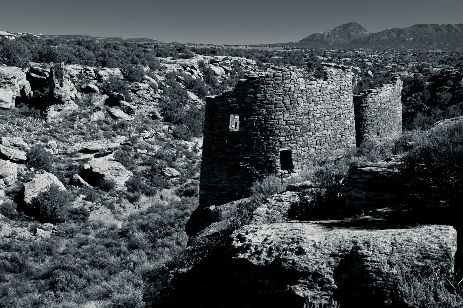
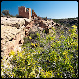
 Santa Clara, CA - Another short post from our 2011 Fall Road Trip. For this set we visit Hovenweep National Monument located right on the Utah-Colorado Boarder (of the six groups of ruins, two are in Utah and four are in Colorado). Suwei and I had good intentions of visiting all of the groups, but if traveling with a baby has taught us anything, it's best not to get your hopes too high. As usual we were moving slower than expected and only had time to visit one group.