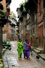
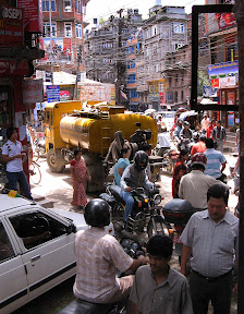
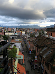
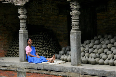
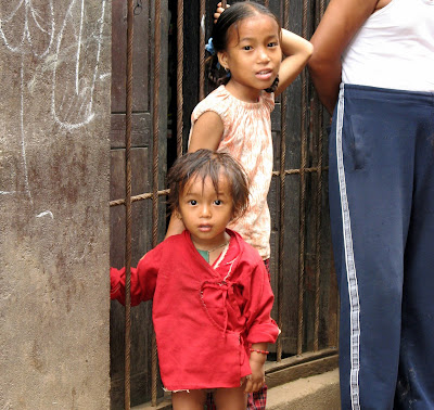
Kathmandu, Nepal
 - The road leading from Lhasa to Kathmandu has been dubbed "The Friendship Highway". I'm not sure who coined the phrase or when it was given to the road, but the name did intrigue me and kept me thinking as I made the 6 day journey.
As a modern version of the ancient trade routes linking Tibet (now China) with Nepal, the Friendship Highway could represent the partnership between two nations profiting from the mutual benefits of trade. Less than 3 years after the 14th Dali Lama fled Tibet, Nepal and China had signed an agreement (late 1961) to build an all-weather highway linking Kathmandu with Tibet. However, by the time the road opened in 1967, Nepal closed the border to trade due to severe restrictions imposed by Beijing. At that time the road's sole purpose was militaristic. The highway provided a direct link to two major Chinese army bases placed within 100 kilometers of Kathmandu. Hardly a sign of friendship.
As a major improvement to the infrastructure of rural Tibet, it could represent a Chinese desire to create a lasting friendship to this remote "autonomous region" and its generous protector. But, we all know that's pretty much a load of crap. China invaded Tibet in 1951 and has governed Tibet since 1959. The Tibetans are still not too happy about this.
We all know and have heard the cry to "Free Tibet". As one travels in Tibet the discussion about the plight of the poor Tibetans comes up a lot. It's one of those topics most aging hippies, new agers, and liberal wanderers really warm up to. Ok... I like Enya and I carry a crystal in my backpack to protect my karma, but... I've also been involved with aid & relief work and I'm not convinced a free Tibet is the best thing for these people. There I've said it (as I'm pelted from all sides with organically grown tomatoes). Some here argue that the exiled Tibetans, with their western ways, can reinvigorate the country and make it even better than the Chinese. I can't see that happening. However, I can imagine another floundering poor country, totally reliant on foreign aid.
Not that what the Chinese government did or are doing is right. They killed thousands of Tibetans in their "Great Leap Forward" (1.2 million according to the Tibetans, other independent estimates extrapolated from census figures put it at closer to 400,000... still no small peanuts). (S - For that matter the Chinese government killed around 30 million of their own during that campaign.) In 2006 they opened a new railway line linking Beijing with Lhasa making it that much easier for the Chinese to migrate to Xizang. (Chinese name for Tibet, broken down literally means west storage. By the way, The English name of Tibet is derived from the Arabic word "Tabbat" which came via Persia from the Turkic word "Töbäd" meaning "the heights". Thank you Wiki.) I'm guessing that the Chinese that have chosen to re-settle in Tibet are pretty keen to make friends. However, it seems most mainland Chinese see Tibet as a kind of cultural Disneyland. Chinese tourists come in droves to buy cowboy hats and snap photos of these strange barbarians (not much different from the foreign tourists really...except for the cowboy hats).
And...how about the foreign tourists? Or "foreign friends" as we are sometimes called. Well, that too is a bit of a farce. For one thing travelers are charged extraordinary amounts for the right to enter Tibet in the form of the Tibet Tourist Permit (or TTP) which is above and beyond the cost of a Chinese visa... and varies depending on where and when you purchase it...and may or may not actually be valid for anything depending on that mood of the Chinese government on any particular day. And...that only gets you into Lhasa. If you actually want to leave the city you must obtain an additional TTP permit for onward travel...and you must be part of group...and the Chinese government may or may not agree with your itinerary even after the permit is issued. Confused? We were. You get the feeling that the Chinese government just wants to grab these "friends" by the ankles and shake them until their pockets are empty.
Ok... I'm seriously rambling. Sorry. Back to the road.
In any case...in Lhasa I chose to ignore most of my thoughts about friendship and worked to meet some new friends of my own, in which to share one of these required tours along the Friendship Highway. Through email and over a few beers I met Katja from Germany, Shinji from Japan, Masahiro also from Japan, and Hoon from South Korea. We managed to find a Land Cruiser, a driver, and a guide through a Tibetan-owned and operated company that we trusted. We were to take the standard tour from Lhasa to the Chinese border via the stops of Yamdrok-Tso Lake, Gyantse, Shingatse, Everest Base Camp and Old Tingri. On August 3rd we paid our man, Tashi and hit the road.

Loading up the Land Cruiser in Lhasa
Most of what we saw has been well documented in the slide show. Therefore, I won't bore you with the details here. However, I will bore you with a few details of what we didn't see. Yamdrok-Tso Lake was on our schedule (and TTP permit), but when we got to the turn, the road was blocked by armed Chinese soldiers marching back and forth. Rumor had it that a Tibetan guy (possibly the son of a prominent official) had been waving a Tibetan flag near the lake. "Very serious", our guide told us. Later, we heard that a woman had been stabbed there, but by that time we didn't know what to believe. In any case we missed the lake.
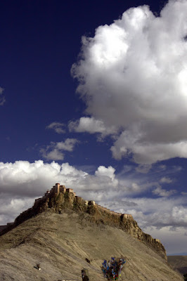

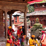
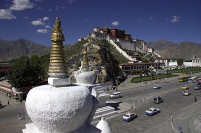
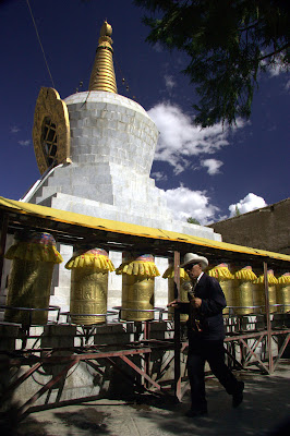
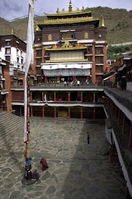
Pelkhor Chode Monastery, Gyantse


It seems that we almost didn't make it to Everest Base Camp either. Two days after the Yamdrok-Tso road closure, the Chinese Government closed the road to EBC. Luckily (or not) we had already made it up there. On that particular day we were busy trying to get our Land Cruiser dug out out of the mud and were looking for replacement bearings for the left hub in order to make it back to the main road. For this closure the rumors were even better. First we heard that there was a special envoy of soldiers, police, or government officials traveling up the road to celebrate the 1 year mark prior to the Beijing Olympics. One problem. The correct date for the 1 year mark was July 26th, though we did see lots of police on the road. (None of which helped us with our broken hub....to their credit the police did make each of us write a statement at the beginning of the road declaring that we understood that they would not take responsibility for our safety. I wrote "ditto" and drew an arrow to the previous statement.)
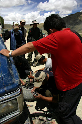
Car Troubles on the EBC Road
The second rumor involved excessive snow melt. The road was supposed to be wiped out by the rushing waters of melting snow caps. Now true we did stick our truck up to the axles in mud for close to two hours, but that was because the 4WD broke as our driver tried to floor it across a creek on a jeep track short cut to Old Tingri. The main EBC road was a mess due to construction, but completely passable.
The third rumor was the best. We were asked if we had seen a naked girl wrapped in a Tibetan flag streak across Everest Base Camp. I had to admit that I didn't see anything...and that that would be something I would probably would have noticed.
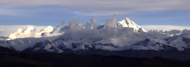
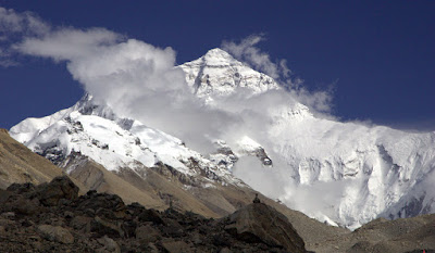
My First View of Mt. Everest. I found the naming of Mt. Everest quite interesting. In the west the peak was originally called "Peak XV" until Radhanath Sikdar, an Indian mathematician and surveyor declared it to be the world's tallest in 1852. In 1865 with both Tibet and Nepal closed to foreigners Andrew Waugh, the British surveyor-general of India, was unable to determine a local name for the peak. He then pushed to have the peak named after his predecessor Colonel George Everest (actually pronounced, EAVE-rest). The Tibetan name for the mountain is Chomolungma or Qomolangma (Zhūmùlǎngmǎ Fēng in Chinese Pinyan) meaning "Mother of the Universe" or "Goddess Mother of the Snows." In the early 60's the Nepali Government realized that they did not have a local name for the mountain and in eventually ended up calling it, Sagarmatha, meaning "Head of the Sky."
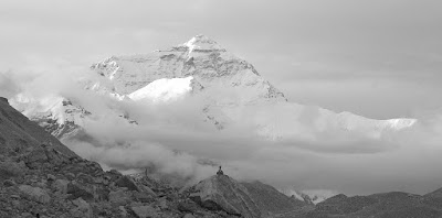
Mt. Everest the morning we left EBC
Our last stumbling block was in the small town of Nyalam, two hours from the Nepali border. First we heard that the road was closed due to an over-turned truck (by this time we were getting a little paranoid of rumors). Then as we pulled up to the red and white striped road block we were told that the road was closed due to construction. Luckily the police were planning on opening it at 7:30pm when the crews knocked off work. After killing 5 hours eating, playing pool, surfing the web, and watching yaks wander through a maze of SUVs the road was opened and we took one of the wildest rides I've ever experienced. The construction crews, by the way, did not knock off at 7:30pm. I got the feeling that if they ever stopped working on that road a good portion of it would wash off the cliff in a rush of water, rock and lush jungle mud. The pictures don't do it justice as most of them were taken while we were leaning out of a bouncing Land Cruiser (no IS lens is that good). When I arrived in Kathmandu we heard the road had closed completely, and that they were no longer issuing permits for this particular tour...but of course, that's just an unconfirmed rumor.

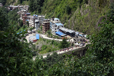
The road from Nyalam to Dram
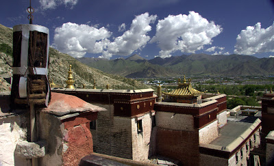
So...the Friendship Highway. If you ask me, I'd say it was a great trip. For all our troubles we did get to see a bit of Tibet. We passed sand dunes and barley fields on the way to Gyantse. We admired the clouds, forts, barley, and a nine-story stupa from atop the Pelkhor Chode Monastery. We ate the smallest bowl of tomato egg soup ever on the roof top of the Jianzang Hotel. We enjoyed butter tea and yak noodle soup outside Tashilhunpo Monastery in Shigatse. We crossed the high Tibetan plateau over three passes greater than 5000 meters. We got to see the highest point on earth, Mt. Everest, at sunset, sunrise, and throughout the day thanks in part to a Japanese charm Masahiro created with toilet paper and a ribbon. We wandered the cliff face town of Zhangmu (or Dram to the Tibetans) precariously placed on top of four wet, jungle-covered switch backs overlooking Nepal. And...we finished up with a 7km walk in no man's land, a bridge of friendship, a border crossing, and a 4 hour taxi ride into Kathmandu. But...what made the trip truly great was the luck of having a crew of first-class car mates. In the end, I guess, I would call them my friends.


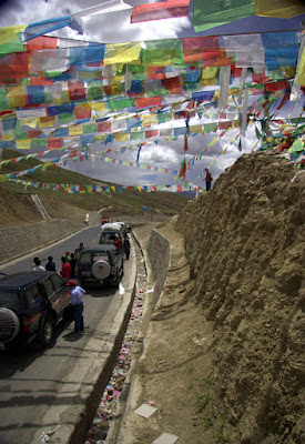

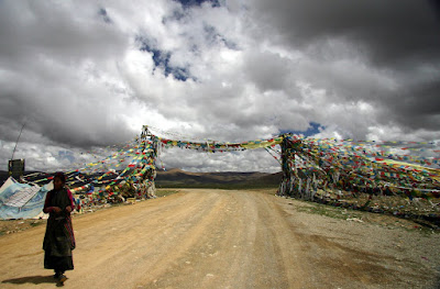


Tibetan Sand Dunes, Gyantse from Pelkhor Chode Monastery, Tashilhunpo Monastery, 4600 Meter Pass, 5246 Meter Pass, 5100 Meter Pass, Mt. Everest, Masahiro's Lucky Charm, Hiking to the Nepal Border from Dram, & The Friendship Bridge.

Too Much Time in a Land Cruiser... from left to right Shinji, Hoon, Masahiro & Karl....Katja took the Picture and Tashi our guide is hiding back there somewhere.
It's a big one...but I would recommend checking out the slide show. Just click the link here: