Thursday, August 18, 2011

Backpacking to Upper Velma Lake in Desolation Wilderness

The Before Photo at the Bayview Campground Trail Head.  From Left Eric, Ken, Eric, T, Phil, John, Rob, Scott and Karl
Santa Clara, CA -  This set of photos come from my first backpacking trip of the year, July 14th to July 18th, 2011.  Actually, I hadn't been backpacking since doing the West Coast Trail last July.  So, needless to say I was ecstatic when John, Phil and the rest of the crew invited me to their annual trip to the Desolation Wilderness and was even more ecstatic when I realized Suwei was somewhat cool with me taking off for almost 6 days.

Eric preps for the hike
If I understood correctly (and there's a good chance I didn't), it was John Romweber and his buddies from Piedmont High that started the tradition of an annual trip out to Desolation Wilderness.  It has since morphed into a bit of a Peace Corps Malawi mini-reunion trip as Phil O'Neill, Eric Bone, & Ken Shockley became regular attendees.  This year they managed to bring myself and Rob Westra into the fold.  I hadn't seen most of these guys in years and years and was looking forward to catching up.

The Hike In - Bayview to Upper Velma:

Trail head:  Bayview Campground
Destination:  Upper Velma Lake
Distance: 4.2 miles
Starting Elevation:  6800 ft.
Highest Point: Maggie's Saddle at ~8400 ft.
Ending Elevation: 8000 ft.
Heaviest Item in Pack: Either the sack of apples or the bottle of whiskey

View of Lake Tahoe from the Bayview Trail
Trail Description:  The two main trail heads for Upper Velma are Eagle Lakes or Bayview.  We chose Bayview, one, because we camped the night before at the Bayview Campground, two, because it saves you a few hundred feet of climbing, and three, because the view from Maggie's Saddle is spectacular.  From the Bayview trail head you start climbing right away through a series of switchbacks ravaged by the dreaded pine beetle (looking on the bright side, less trees mean more glimpses of Lake Tahoe).  About 1 mile of this and 880 feet of elevation gain brings you to Granite Lake.  After the lake the trail gets a bit steeper for another 700 feet of elevation gain, but you are soon rewarded with a great view of Eagle Lake and beyond from Maggie's Saddle. 

Phil takes in the view of Eagle Lake from Maggie's Saddle
From there the trail flattens out offering views of Mt. Tallac, Azure Lake and Snow Lake.  At 2.7 miles from the trail head you reach another saddle and the intersection with the Eagle Lakes Trail.  It's another 0.6 miles to the next trail intersection. Left takes you to Dick's peak & right leads to Upper Velma.  From there the trail drops about 300 feet and before you know it, you are at the Lake.
After Maggies Saddle the trail flattens out as it follows the contours past Azure and Snow Lakes
The Hike in to Upper Velma

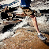
River Crossing at Upper Velma
Our Plan: We crossed the river at the lower end of the lake and made our way around the Northwest side.  We set up camp atop a rocky outcrop just above the squeeze point between the upper and middle parts of Upper Velma.  There was plenty of space for our 9 tents, a good jumping rock, and even a little pond complete with icebergs within view of our kitchen.  Pretty much a perfect spot. Our plan was to stay there for 3 nights and explore the area sans backpacks.

Panorama of our campsite at Upper Velma

Day Hike #1 - Fontanillis Lake, Dick's Lake & Flem Nubbin

On Saturday we decided to follow the cascade at the southwest end of the lake up to Fontanillis Lake (8360 ft.).  The north side of the cascade was almost completely free of snow, whereas the south side was almost complete buried.  Fontanillis Lake was still very much snowed in.  About a third of the lake was still iced over.  We toured a camping spot from previous versions of this trip and decided that the leaping from the old jumping rock was not such a good idea this year.  Although, Eric did manage to make his way across the ice and go for a very fast and furious swim.

Crossing the Cascade above Upper Velma
The View from Fontanillis Lake
Panorama of Fontanillis Lake

From Fontanillis Lake we followed the trail southeast to Dick's Lake.  No one swam in Dick's Lake.  By this time half the group had returned to camp for more whiskey.  A few of us in Team Over Achiever (Phil, Scott, Ken, Eric & I) had our eyes set on Dicks Peak, but... because of the amount of snow and the time of day, we decided to revise our ambitions and just head up to the relatively snow free ridge to the east to see what we could see and re-evaluate.  We ended up climbing up to a rocky pinnacle on the ridge at an elevation of about  9200 feet.  We dubbed it Phlegm Nubbin after the copious amount of mucus coming out of Phil's head.  Despite the name it was quite a wonderful place to be, offering great views of Dick's Lake, Dick's Peak, Mt. Tallac, Azure Lake, Snow Lake, Lake Tahoe, all three Velmas, Fontanillis Lake and pretty much everything else we saw on this trip.

The View from Phlegm Nubbin.  From left: Dick's Lake, Fontanillis Lake, Upper Velma Lake, Middle Velma Lake
From Phlegm Nubbin we followed the ridge down to the west, glissading down snow patches when possible.  After crossing the Dick's Lake Trail we continued north cross-county to Upper Velma and back to camp.  Don't ask me about mileage.  I have no idea.

Ken and Scott Glissading

Day Hike #2 - Lower Velma & Middle Velma

On Sunday we followed the river down the hill to the northeast to Lower Velma Lake (Elevation 7700 ft.)  The high granite cliffs at the south end of the lake offer great views of what I consider the most appealing of the three Velmas.  We made our way around the west side of the lake to a prominent, granite peninsula for lunch and a little leaping into the lake.

Lower Velma Lake
Ken Dries out after a swim / Deciding where to go next

After lunch we made our way up between a few cliffs at the west side of the lake.  A little further east of the steeps we arrived at Middle Velma Lake.  This lake had no steep sides and looked pretty shallow.  There were lots of camping sites around it, but the whole place way quite buggy.  The mosquitoes we going nuts.  Strange especially since the mosquitoes at the other two Velmas weren't bad at all.  We made our way counter clockwise around the lake, then aimed back for camp at Upper Velma.

Middle Velma Lake
The Hike Out - Upper Velma to Eagle Falls

On Monday it was time to head out.  We basically followed the same trail out until we reached the Eagle Lake junction.  From there we decided to exit the wilderness via the Eagle Falls Trail.  From the saddle/junction the trail drops pretty consistently for about 600 vertical feet, taking you past Eagle Lake and Eagle Falls and finally to the Eagle Falls trail head off Hwy 89. 


From the Eagle Falls trail head John and I had planned to hitch hike back to the Bayview Campground to fetch the cars.  However, I guess we might have looked a bit too scruffy to warrant a ride.  Although there was a constant stream of traffic heading up the hill, we ended up walking the whole thing.  Luckily it was only another half mile to a mile up Hwy 89.

Hiking out Via the Eagle Falls Trail

After loading the cars we quickly made our way to Cantina Bar and Grill, (one of the first eating joint on the way back to town) for lunch and brews.

And that pretty much sums up our Desolation Weekend.  Although we did spend one more night at the Mont Bleu Casino at State Line and a few of the guys did quite well at the craps table.

Thanks to John for coming all the way from Germany to put all this together.  Eric, Rob, Ken, John, & Phil, it was great to see you guys again!  Eric, T, & Scott, very cool to meet you guys.  I hope I'm invited back next year.

Here is a link to the slide show:

Backpacking in the Desolation Wilderness, CA


Monday, August 15, 2011

Russian River Canoe Trip - 2011

Russian River Canoe Trip, 2011!
Santa Clara, CA - It seems our Annual Russian River Canoe Trip is starting to get big again. This year we had 59 people (and one dog) out on the river, and close to 70 folks there for the BBQ Saturday night, and all that after we made an emergency date change.

We've been doing this trip some 18 years now and I've almost always planned it the 1st weekend in June. In those some 18 years it has never, I repeat, never rained on us. Oh, it's been cold some years, windy others. It's been cloudy, but it has never, never rained. Well, first time for everything I guess. This year June 4th, our original day of departure, had a black cloud floating over it. As the date got closer the cloud got darker and more ominous. It soon became evident that that particular June 4th was going to be one of the wettest in history. As the last minute cancellations came pouring in, I was beginning to think it was only going to be Brent and I out on the river.

Anyway... just as it started raining we moved the whole extravaganza to July in the hopes that summer would rear it's pretty head by then. In the end it truly was the right decision. We only lost about 10 people and gained a few more than that... AND... the weather was perfect.

Thanks to everyone for making this another stellar year. Thanks to Doug, Erhhung and Eng-Shien for sending me photos (I don't take my camera down the river). And finally, thanks to Tyler, Tyler, Scott and Andy for expertly maneuvering the kegs down the river and for providing libations to all.

Here are a few photos from this years trip (for additional photos be sure to check out the link to the slide show below):


So, ummm.... where'd everyone go?
If you are interested in joining us next year, here are some links you should check out:

Here is the link to our brand new Google group: http://groups.google.com/group/RussianRiverCanoeTrip?hl=en
Here is the link to the facebook invite: https://www.facebook.com/#!/event.php?eid=134686879935950

Here are some links to photos from past years:

2010 - http://somehowlostagain.blogspot.com/2010/11/russian-river-canoe-trip-healdsburg-ca.html
2009 - http://somehowlostagain.blogspot.com/2009/06/russian-river-canoe-trip-healdsburg-ca.html
2008 - http://somehowlostagain.blogspot.com/2008/07/russian-river-canoe-trip-healdsburg-ca.html
And a big miss mash of years on Facebook going back to 2001 - http://www.facebook.com/event.php?eid=109770982368574#!/album.php?aid=83062&id=649406713

If anyone has any old pictures from past years that they would like to send I'll thankfully accept them. If you know the year they were taken, even better!

If anyone is reading this and would like to plan their own trip, I highly suggest calling Lollie at River's Edge Kayak and Canoe in Healdsburg. They have been very good to us!

Camping info can be found at http://www.alexandervalleycampground.com/

Here are some pics from the BBQ:


Thanks again! See you all out on the river next year!

Here is a link to the slideshow:

Russian River Canoe Trip 2011